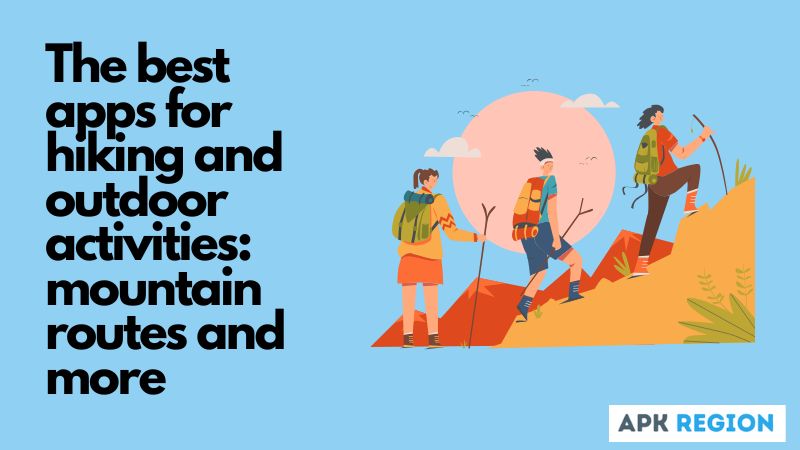
Exploring trails and mountains is a passion of mine, and over the years I’ve found that a good hiking app transforms the outdoor experience. I’ve tested numerous apps and have selected what I consider to be the best hiking apps to share with you.
These tools have not only helped me discover fascinating routes, but have also been essential for my safety and orientation in the wild. I have explored everything from apps that map out my routes in real time to comprehensive trail guides, all designed to enrich outdoor adventures.
Don’t miss them.
This is my selection of apps:
- Best Hiking Trail Apps of 2024
- Wikiloc
- Strava
- ViewRanger
- AllTrails
- FATMAP
- Komoot
- Gaia GPS
- Maps of Spain
- bergfex
- GPX Viewer
Best Hiking Trail Apps of 2024
In 2024, hiking is one of the most popular ways to reconnect with nature and escape the routine. Choosing the app that best suits your needs will transform your mountain getaways into unforgettable adventures. Forget about home exercise apps and get outdoors.
Wikiloc
We start with Wikiloc. This is probably the best app for hiking and 75 other outdoor activities since 2006, with over 5 million users and access to 15 million routes. Its features include visual route rating, offline maps , detour notifications and live tracking, as well as being compatible with Garmin devices.
Despite requiring Wikiloc Premium for all features and compatibility limitations, it stands out for donating 1% of subscriptions to For the Planet, emphasizing its commitment to conservation. Wikiloc allows us to discover the route that best suits our needs.
Strava
Strava captures the essence of hiking, allowing you to monitor key metrics such as heart rate and distance traveled. It is an app compatible with activity bracelets and the Beacon function for real-time location stands out among its features.
However, it faces limitations such as features exclusive to its Premium version and maps with restricted zoom. Despite these cons, Strava remains a valuable tool for outdoor enthusiasts, encouraging continuous improvement of personal performance and being one of the best free running apps that you can also use as a walking app .
ViewRanger
ViewRanger offers an offline navigation experience for hiking and biking , highlighted by the ability to download maps before your adventure. Routes come from an active community, tourism agencies, or shared experiences, providing live tracking of metrics such as heart rate and kilometers traveled.
Compatible with multiple devices and with accurate maps, its intensive use of GPS can affect battery life. Despite not having voice guidance, its free version provides a rich experience, with Premium options for those looking for more topographic detail.
AllTrails
AllTrails is ideal for beginner hikers, offering access to over 100,000 trails worldwide, rated by difficulty, length, and user ratings. It allows downloading maps for offline use and the ability to share experiences and locations.
Features include detour notifications and maps with environmental information. Although it contains ads and requires a subscription for the full version, AllTrails allocates part of the revenue from the Pro version to environmental conservation and is also useful for cyclists.
Read Also:Best Android Auto Apps 2025: Official and Unofficial
FATMAP
FATMAP is an invaluable mobile hiking app for mountain sports enthusiasts, offering 3D maps for skiing, mountain biking, and trekking. It allows downloading offline maps and offers routes with professional advice.
Despite being a relatively new app with some features in development, its main advantage is the low battery drain in offline mode. However, it requires a subscription for all features and the variety of maps may be limited in areas with less tradition of mountain sports.
Komoot
Komoot lets you record your routes to share, ideal if you love exploring nature on foot or by bike. It lets you plan your journeys, discover new trails and share your adventures with an active community.
With tools that make tracking and navigation easy, and the ability to add photos and highlights to your routes from your phone, Komoot is an indispensable companion for outdoor sports. Its intuitive interface and ability to work offline ensure that you always have access to your maps and routes, no matter where you are.
Gaia GPS
Gaia GPS has a wide range of features designed to enhance your weekend getaways and outdoor adventures. With this app, you can take the road less traveled, record your routes and access detailed maps, even without an internet connection. Plus, it’s completely free for basic use.
It includes shortcuts to download map sections for offline use, ensuring you always have the guidance you need, no matter where you are. While the basic subscription offers many features, the Premium version expands the possibilities, including extra functions, specialized maps and routes around the world.
Maps of Spain
Developed by the National Geographic Information Centre (CNIG) of the National Geographic Institute, this hiking application provides access to topographic maps and other geographic resources, making it easier to plan and track routes.
It has features such as downloading maps, making it ideal for your weekend getaways in nature. The basic cartography comes from maps from the National Geographic Institute and other ministries, offering a wide variety of detailed information so you don’t get lost in the mountains.
bergfex
With bergfex, you can find hiking routes that suit your preferences, using guided navigation to explore safely. This app not only allows you to access over 100,000 routes in Europe, but also to create your own routes, making it easy to plan and track your outdoor activities.
It offers detailed maps of the Alpine region and other useful features to get you to your destination without any hassle. Plus, you can log your rides, getting complete statistics of your activities.
GPX Viewer
With this free GPX trail tracking app you can easily fine-tune your outdoor exploration. This app allows you to use different filters to adjust your search to the difficulty, making it easy to find the perfect trail for your next adventure.
Plus, mapping routes through national parks is made easy, allowing you to plan your getaways in detail. Ideal for hikers and cyclists, GPX Viewer is the essential tool for those seeking adventures tailored to their preferences and abilities.
After trying out a number of options, these best hiking apps have become indispensable companions on each of my expeditions, along with a good compass app , apps for identifying plants , and flashlight apps , in case it gets dark.
I hope my recommendations inspire you and equip you for your next adventures. And if you go on night routes, download one of the best apps to see the stars in real time .

